cartcart

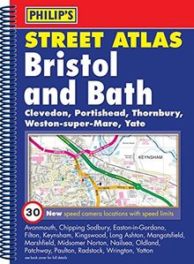
    Philip's Street Atlas Bristol and Bath (Philip's Street Atlases)

     
    From unknown
    Only 1 items left in stock
    Philip's Street Atlas Bristol and Bath (Philip's Street Atlases)

    Description

    A street atlas of Bristol and Bath which provides gives coverage of the county and unitary authority. The route planner shows the A and B roads, and can be used when driving to get close to the destination before turning to the relevant large-scale street map. It also includes an index which lists street names and postcodes, and hospitals.

    Product details

    EAN/ISBN:
    9780540091874
    Edition:
    Rev Ed
    Medium:
    Other bindings
    Number of pages:
    192
    Publication date:
    2007-10-29
    Publisher:
    Philip's
    Languages:
    english
    EAN/ISBN:
    9780540091874
    Edition:
    Rev Ed
    Medium:
    Other bindings
    Number of pages:
    192
    Publication date:
    2007-10-29
    Publisher:
    Philip's
    Languages:
    english

    Shipping

    laposte
    The edition supplied may vary.
    Condition
    Condition
    Learn more
    €2.49
    available immediately
    €2.49
    incl. VAT, plus  Shipping costs
    paypalvisamastercardamexcartebleue
    • Icon badgeChecked second-hand items
    • Icon packageFree shipping from 19 €
    • Icon vanWith you in 2-4 working days

    Recommended for you