cartcart

    Children's Illustrated Atlas (Dk Childrens Atlas)

     
    Only 1 items left in stock
    Children's Illustrated Atlas (Dk Childrens Atlas)

    Description

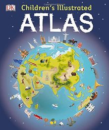
    DK's Children's Illustrated Atlas brings geography to life. It is packed with colourful maps, for kids and fascinating facts about the countries of the world. Each map is bursting with information, combining colourful icons with photographs representing key points about each country. The atlas includes a world map, with a political map for each continent. Children are shown how to use a key, compass, and scale. This charming and informative book is a key addition to every child's library.

    Product details

    EAN/ISBN:
    9780241228074
    Medium:
    Bound edition
    Number of pages:
    128
    Publication date:
    2016-08-01
    Publisher:
    DK Children
    Languages:
    english
    EAN/ISBN:
    9780241228074
    Medium:
    Bound edition
    Number of pages:
    128
    Publication date:
    2016-08-01
    Publisher:
    DK Children
    Languages:
    english

    Shipping

    laposte
    The edition supplied may vary.
    Condition
    Condition
    Learn more
    €12.49
    available immediately
    New €16.00 You save €3.51 (21%)
    €12.49
    incl. VAT, plus  Shipping costs
    paypalvisamastercardamexcartebleue
    • Icon badgeChecked second-hand items
    • Icon packageFree shipping from €19
    • Icon vanWith you in 2-4 working days