Sell books & media
Buy books & more
Watchlist
Sign in
All categories
All
x
From
show all
unknown
(157)
Publicpress
(22)
bikeline
(20)
Esterbauer
(19)
baden-fur-geoinformation-landent
(9)
Bernhard Pollmann
(8)
Otmar Steinbicker
(7)
ADAC Kartografie
(6)
allgemeiner-club-deutscher-e-fah
(6)
Esterbauer Verlag
(6)
Ulrike Poller
(6)
Regionalverband Ruhr
(6)
Freytag-Berndt und Artaria KG
(5)
artaus
(5)
Erhard Jübermann
(5)
GeoMap
(4)
KOMPASS-Karten GmbH
(4)
Walter Theil
(4)
Hans-Jürgen Fuß
(3)
Hans-Peter Vogt
(3)
fur-geobasisinformation-landesam
(2)
Condition
Very good
(1)
Good
(1)
Price
€1 - €2
(1)
€2 - €5
(1)
Medium
show all
Other bindings
(2)
Sonstige+Einbände
(0)
This filter selection is automatically applied to the "Books" category
Language
Dutch
(1)
Category
show all
Books
Travel & Adventure
Atlases, maps & plans
By country & region
Europe
Germany
Rivers
Rivers
(1)
Home
Books
Travel & Adventure
Atlases, maps & plans
By country & region
Europe
Germany
Rivers
Rivers
filter (3)
fur-geobasisinformation-landesam
Sonstige+Einbände
Rivers
Only available items
Popularity
Price: ascending
Price: descending
Oldest articles
Latest articles
Popularity
Moselsteig Karte 3 (WR): Topographische Karte 1:25 000 mit Wander- und Radwanderwegen mit dem Moselsteig von Zell bis Koblenz
from
Landesamt für Vermessung und Geobasisinformation Rheinland-Pfalz
Used - very good
Book - Used - very good
New
€5.90
You save €1.35 (22%)
Book
€4.55
You save €1.35 (22%)
New
€5.90
€4.55
Add to watchlist
More Details
Add to Cart
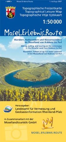
Mosel.Erlebnis.Route (M.E.R.) Wandern, Radwandern und Wasserwandern im Moselland von Koblenz bis Perl: Topographische Karte 1:50000 mit Wander- und ... Rheinland-Pfalz 1:50000 /1:100000)
from
Landesamt für Vermessung und Geobasisinformation Rheinland-Pfalz
Used - good
Book - Used - good
New
€3.00
You save €1.51 (50%)
Book
€1.49
You save €1.51 (50%)
New
€3.00
€1.49
Add to watchlist
More Details
Add to Cart